Monday 1 November 2010

Ben A'an

1.11.10 Ben A'an 454m 4 hours circular route 6km
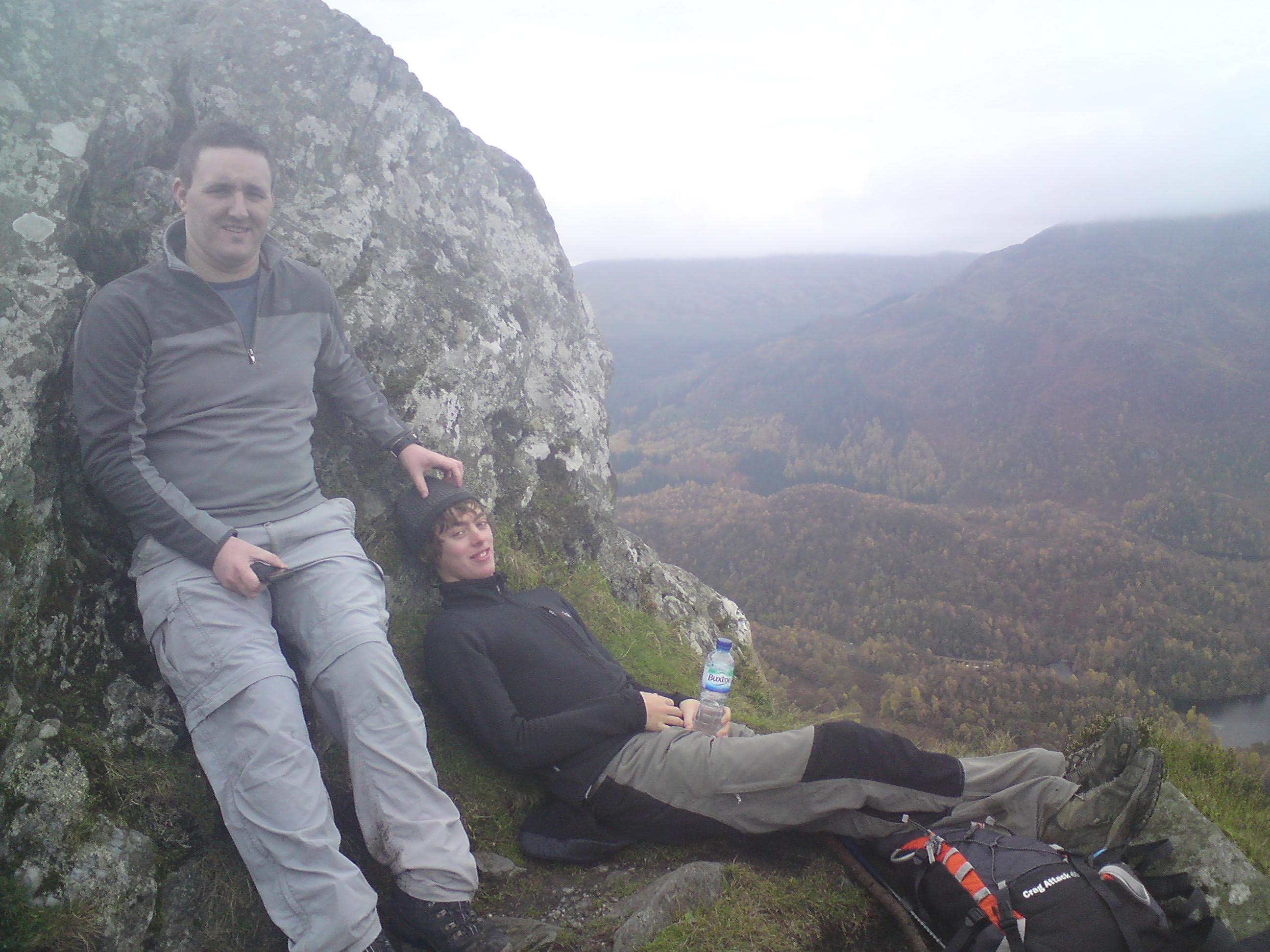
 Followed the path NW up from the car park at Loch Achray to the summit of Ben A'an 454m. Walked NW to the fence and followed this SW down the Bealach an Duine to the road at Loch Katrine. Followed this road back onto the A821 and back to the car park. An overcast day with Miles and Russell.


Friday 15 October 2010

Ben Chonzie


(15.10.10)  4 hours 30 min Ben Chonzie 931m 3054ft 14km

Me & Russell started at the car park near Invergeldiein Glen Lednock and followed the path up beside Invergeldie burn N then NE along the broad summit ridge. Before the path ended took the faint path NW then NE following the fence to the summit. Had lunch then descended taking a bearing SW to the head of Allt a' Choire Riabhaich and followed the burn down the heathery, bracken slopes to Invergeldie burn. Followed this S back to the junction of paths the back to the car park. Weather was high cloud with clear views.


Monday 20 September 2010

Weekend to Torridon & the Gorms


(18.9.10) 16.7km, 8 hours Coire dubh Mhoir- Loch Coire Mhic Fhearchair - Coire Mhic Nobuil

Started at the car park W of Torridon off the A 896.  Followed the stalkers path up the Coire Dubh Mhoir in between Liatach and Beinn Eighe. Walked further along the river Altt  Coire Dubh Mhoir NW until it was crossable due to the heavy rain. At the path junction we took a right at the foot of Sail Mhor. The pathed contoured around to the right,NE, rocky and steep at times with views to various Lochans. Ascended up steep stones with views over to waterfalls.The Triple Buttress as Loch Coire Mhic Fhearchair  finally reached.600m.  Descended back to the path junction SW then followed the wet, boggy,marshy path W along the Abhainn Coire Mhic Nobuil glen between Liatch and Beinn Alligin. The path through Coire Mhic Nobuil continued SW until we crossed the car park on the west side of the Abhain Coire Mhic Nobuil, about three kilometres west of Torridon village. Found a camping space near Torridon house in the forest. The weather was heavy rain for 2 days.


(20.9.10) 7 hours 30 min Bynack More 1090m. 21km

Drove from Torridon to a bothy as we were sick of the rain. After a night in Ryvoan bothy we joined the Lairig an Laoigh path & crossed the river Nethy. Took the path on Bynack More's north eastern slopes in a SE direction with the path like a river at times due to the heavy rainfall. The Lairig an Laoigh swings to the left of the mountain. At the junction took the path S to the flat plateau at the 818 top and carried on S up the rocky ridge to the summit 1090m. Took bearings S and SE to the barns of Bynack then another bearing NE down the steep heathery slopes to join the Lairig an Laoigh below Coire Odhar and then back around NW descending to Ryvoan bothy and then back to the car at Glenmore. 


Saturday 31 July 2010

Ben Vorlich (Loch Earn)


(31.7.2010)   Ben Vorlich, Loch Earn (985m/ 3231ft)  4 hours


Me and steve followed the path up from ardvorlich house into glen vorlich then up the path on the ridge towards the summit. The weather was overcast with mist and fog towards the summit. Returned via the same way.


Saturday 24 July 2010

Meall Garbh & Meall Greigh (Lawers Range)

(24.7.10) Meall Garbh 1018 m, Meall Greigh 1001m, 15km, 6 hours 30.

 Parked at the Ben Lawers hotel where we began our walk. Me,steve and fitz. Walked along to Machuim farm and then followed the track up on the west side of the Lawers burn then onto the landrover track. Followed it to the dam then W to Lochan nan Uan. Went around and climbed the steep slopes N of Lochan nan Cat to the Belach between An Stuc and Creag a Bhuic to the summit of Meall Garbh. Descended E and followed the path to the col before the climb to Meall Greigh. Descended south through the heather to to the Lawers burn and back to the start.


Friday 14 May 2010

Glen Feshie

11.5.10 Glen Feshie, The Cairngorms National Park, Achlean-  bothy  7km, 4 hours

 Part of my work placement for east lothian outdoor education department i assisted a group 0f 11 s2 and s3 high school students,knox academy on an exped to the cairngorms. Walked from car park north of Achlean and followed the path down until we crossed the river nethy. Followed the path through the forest to the bothy. The weather was overcast with rain then heavy snow at times.


12.5.10 Glen Feshie, The Cairngorms National Park, 5km, 4 hours

 From the bothy we followed the path up through the forest to around 600m just before Lochan  nam Bo. We cut across open heather back around near  the river Allt Coire nam Bo and back to the bothy. Sunny with snow showers.


13.5.10 Glen Feshie, The Cairngorms National Park,   bothy to Achlean, 7km, 4 hours

 The walk out of glen Feshie involved following the River Feshie and then walked circular through the forest before crossing the river and following the track back.


Wednesday 5 May 2010

Stob Ban & Mullach nan Coirean


5.5.10 The Mamores, Stob Ban 999m & Mullach nan Coirean 939m 6hours,14km


Started at the car park east of Achriabhach and took the stalkers path SE along the Allt Ciire a' Mhusgain to the head of Coire a' Mhusgain. Headed W up the east ridge of Stob Ban up the scree and boulders to the summit. Descended S then W along the ridge to the col between Coire na Sleubhaich and Coire an Lochain. The ridge drops SW to a cairn before heading NW to the summit of Mullach nan Coirean 939m. Descended via Mullach's NE ridge down to the forest and the forestry road. The day was cloudy with low visibility above 600m.


Thursday 29 April 2010

Meall a' Bhuachaille


27.4.10 Meall a' Bhuachaille 810m The Cairgorms National Park , 3 hours, 10km, solo


Walked up from Glenmore campsite and followed the path NE passed Glenmore lodge into ancient pine forest, up by An Lochan Uaine and through the Pass of Ryvoan. Then up to Ryvoan bothy before following the path W up the E slopes zig zagging to the braod stoney summit of Meall a' Bhuachaile. Descended W to the col between Meall and Creagan Gorm and then S on the footpath through Glenmore forest park back to Glenmore campsite. The weather was cloudy with light drizzle, clear at the summit with 40'50mph winds.


Wednesday 10 March 2010

Bishop Hill

 Circular Lomond Walk, 13km,4 hours 30 min, 460m ascent


With the college we parked at West Balgothrie and walked north east passed Holl reservoir. Then west passed Ballo reservoir  through the forest by Harperleas reservoir along the snowy and boggy path to glen vale. Climbed south up the steep slopes to the summit of Bishop hill then east passed west and east feal farm back to the car park. The sky was cloudy with sunny spells and parts of the walk were a foot deep of snow at times.


Tuesday 9 March 2010

The Southern Uplands

 Ettrick valley,14.2km,6 hours,30 min.


Started at Potburn road end NT 188 093 with the college on the southern upland way and followed the path NE through the forest to Bught Hill 580. Took a bearing west to Bodesbeck Law 665m then descended south before ascending west to Faulsdie Hill 568m and S to White Shank 622 using the fence as a handrail. Followed it on to Smidhope Hill 644m, SE to Capel Fell 678m then descended and climbed E to Wind Fell 665m. NE on to Hopetoun Craig 632. From here we descended NE then followed the land rover track NW  passed Over Phawhope bothy and back to the potburn road end. Practised bearings and aiming off to collective features then using it as handrails. Heather wet and boggy with snow a foot deep which made walking difficult at times. 


Ptarmigan November Meet (Callander)

(6.11.2016) Ben Vane & Ben Ledi, 23km. 7hrs. 1,067m ascent Ptarmigan November Meet high tea was at the Lade Inn, just outside Callande...