(8.6.13) Beinn Dubhcraig, Ben Oss, Ben Lui, Beinn a’Chleibh, 9.5 hours, 19.3km,ascent 1654m
With
One last effort saw us descending SW down the broad ridge to the bealach then
zig zagged up the


With
One last effort saw us descending SW down the broad ridge to the bealach then
zig zagged up the
(17.5.2013) Glenfinnan to Corryhully Bothy, 5km. 1 hour ish
Arranged for tam to pick me up at 2. Picked me up at 3. Cheers Tam ;-). Set off with Paul on our way tae pick up steve. Banter was flowing as we rocked intae Muthill. Hello to Helen then we were off, west by Loch Earn then North through Glencoe. Stopped off at Fort Bill for a chippy. Filled up at the petrol station to the amusement of some wierdo smiling at us. Maybe we’ll see um in his Y fronts doing yoga in front of the bothy fire in the morning.” I quiped . Rocked up to the Glenfinnan hotel for a quick jar. Banter with the manager who Tam kent (he’s played a few gigs there.) then we were on our way up through Glen Finnan at dusk guinness in hand as Tam cracked open the 12 pack. After an hour of great banter we caught site of corryhully bothy in what little light there was. Walked in hoping it would be empty but an old guy was snoring away. Steve got the fire on the go as we sorted our gear. Fired outside on the bench and got stuck into the rest of the guinness and whisky as the banter flowed aboot the outdoors, mountains and life. Paul highlighted the classic but dark plight of dolphin rape.


(18.5.2013) Corryhully Bothy to Sourlies
Bothy. Average 20mile/32km/10 hours
In the morning I awoke with a slightly sare heed. There was a faint muffle of “ I hope you’s put money in the donation box.” We found out it was the estate owner. Chatted away to the old boy aboot mountains. He was like “you couldve woke me up if id kent yis had bevy.” Packed up after breaky, left a wee donation in the bothy money box then we were off. The weather was cloudy with outbreaks of rain as we started the initial climb. It was steep and hard going and i was concerned about prevoius tinnitus and pain in my ear. I also had back pain as we walked. The weather was overcast with slight rain. Followed the landrover track in a NE direction which climbed slowly up towards the Bealach a’Chaorainn 471m. We struggled with this climb, well I did and soon we were descending down Gleann a’ Chaorainn with good views down the glen. The descent was pretty boggy and felt endless, following a faint path. Random banter still flowed particularly the word Niddrie was thrown aboot a few times. Further down a river crossing had to be negotiated over the Allt a’ Chaorainn. The path was closed in Glen Dessary forest so we headed E following the River Spean. This was a total bog fest and paul went baw deep in the bog much to our amusement. The bog was like a loch at times as we crossed over the fence over up by Strathan and onto the Land rover track at Loch Arkaig. Me and Tam waited at the footbridge for the others to catch up. Tam cracked open his last can of guinness, much to my jealousy. After a quick bite to eat we headed NW along the track passed Glendessary Lodge. The distant jagged knoydart peaks opened up in the horizon. At Upper Glendessary we took the path SW over from A’Chuil bothy. Crossed the footbridge over the River Dessarry and followed the path through Glen Dessarry forest which followed the river. This made a nice change of terrain. By now all of us were feeling pretty fatigued as we climbed up and up out into the edge of the forest. Another bite to eat and the waterproofs were quickly slapped on as we began the last push NW to Sourlies bothy. The path followed the Allt a’ Ghiubhais to the Bealach an Lagain Duibh and W meandering through the rocky pass Mam na Cloich’ Airde. The path zig zagged passed Lochan a’ Mhaim and over rocky terrain before Loch Nevis came into view. Then there was the long descent down by the Finiskaig River. At this point we were all pretty happy to see the bothy in the distant as we had been walking for nearly 10 hours. Hunger and fatigued had well set in as we trekked on auto pilot. On the shores of Loch Nevis the bothy grew closer. The smell of the sea filled the air and sheep grazed close by the ruins of Finiskaig. Entering the bothy we were greeted by a friendly face, Dave, who was trying to get the bothy fire going but unfortunately the bothy fire wasn’t playing ball. Dave was an Englishman who had been paid off from his job and decided to walk from coast to coast, East to West. Got my gear sorted before cooking up some noodles for scran. Went looking for water later and found a dead sheep in the stream above the bothy therefore decided to go further along and higher up. Later we got the banter on the go as the rest of my red wine got tanned. Whisky was consumed in copious amounts.


(20.5.2013) Sourlies bothy to Inverie 12km
average, ascent 550m
Woke up in the morning after a mixed nights sleep. Rain battered off the tin bothy roof. Packed up, had breaky, said to Dave we would meet him for a pint then we were off. Followed the coast line around the head of Loch Nevis and NE across marsh land over to the ruins of Carnoch Village. Crossed the river Carnoch over the dodgy bridge and started the steep climb up by the Allt Carnach. By this point Dave steamed passed us as we struggled with the climb due to our heavy packs and the sun beating down. We eventually made it to the top of the Mam Meadail pass and stopped for lunch. Chatted to a Glasgow boy as he was passing through. Dave had lunch with us and I asked him if he was a fan of Prisoner. Don’t think he’s watched it. From the top of the pass around 550m we could see Inverie in the distance. Descended W down the path following the Allt Gleann Meadail, over the footbridge and along by the Inverie River. Inverie was in the distance as fatigue was beginning to kick in but we finally go there. Set up our tents at the campsite then we were off for a great night in ‘the Old Forge’ Banter and tunage flowed as Tam and Paul played a cracking set with a great sing song.


Scald Law on a lovely, spring like, snowy day. Me and Neil walked up from the car park layby at the A702 just before Silverburn. We headed up to the summit of Scald Law & returned the same way.


Parked on the layby , west side of the A82 just north of the
turning for Kirkton Farm. Began the walk by crossing the road and following the
Kirkton lane down over the bridge and along the track to the Farm and then past
the priory of St Fillan. Left the


Got the citylink from
My first walk since being diagnosed and I felt okay even though previously I had suffered with bacK pain and vibrations when walking. The weather made the walk.


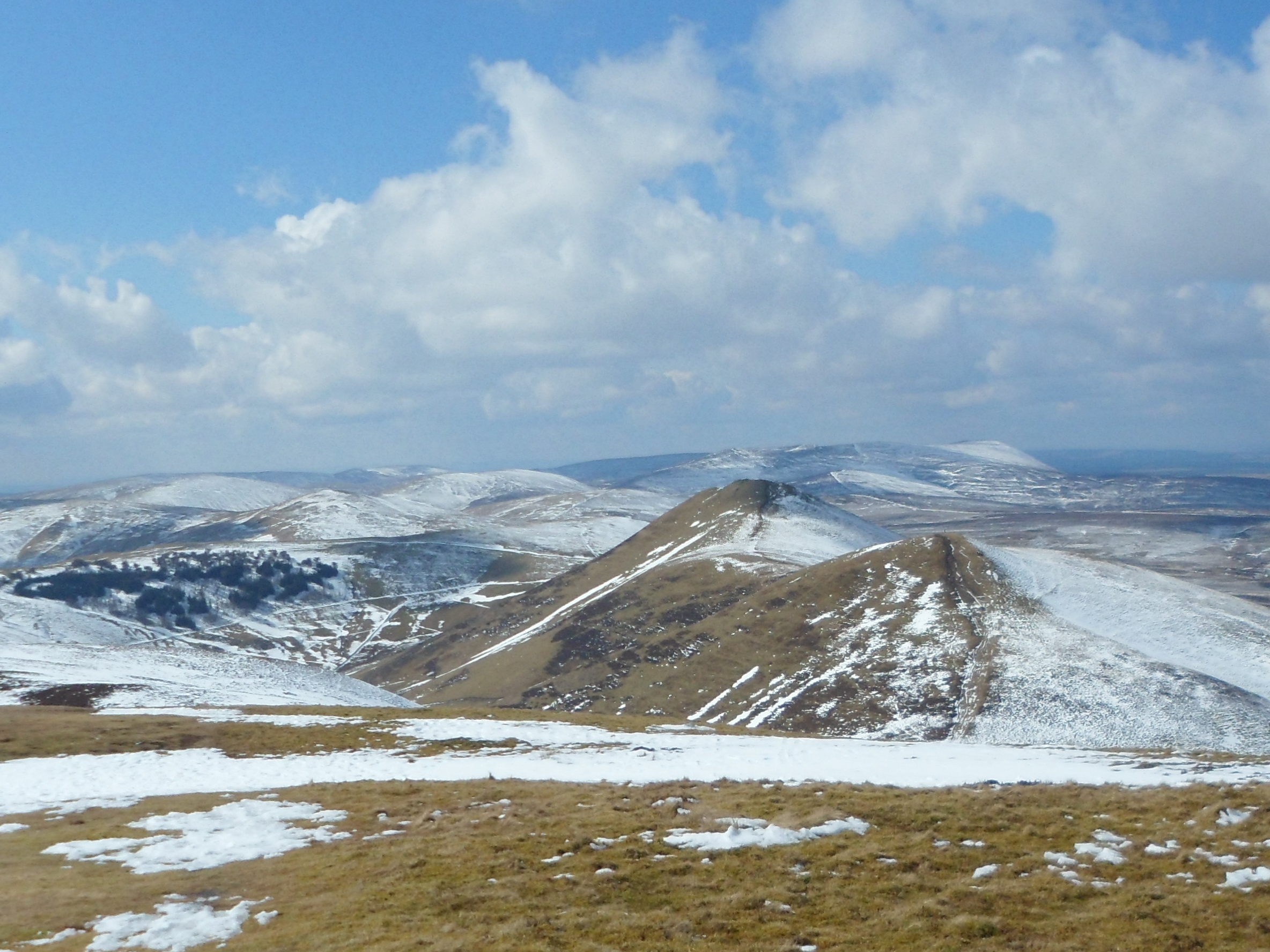
(28.4.2012) Carnethy
Hill 573m, 10km, 4.30 hours
Me and Neil started at the Flotterstone car park and ranger
centre. Headed West ascending the ridge onto Turnhouse Hill and then SW descent and re ascent to the
summit of Carnethy Hill. Descended West
around 130m of height to the bealach, again marked by a fence. An old
right of way - the Kirk Road. Then North to the Howe before the tarmac road
beside Loganlea reservoir. The road runs NE beside the


(6.11.2016) Ben Vane & Ben Ledi, 23km. 7hrs. 1,067m ascent Ptarmigan November Meet high tea was at the Lade Inn, just outside Callande...


