Spent a few hours climbing and belaying on various single pitch crags on a sunny day with Miles and Badger. Also did abit of lead climbing.
Saturday, 30 January 2010
North Berwick Law Climbing
Spent a few hours climbing and belaying on various single pitch crags on a sunny day with Miles and Badger. Also did abit of lead climbing.
Tuesday, 12 January 2010
Dunkeld
12.1.10 Dunkeld circular low level walk (Tay Forest Park) 4 hours 20min, 11km,Ascent 180m
With the college we started at Dunkeld and walked north then west along the River Tay passed Inver. Walked south through forest paths in the Ladywell plantation with the snow a foot deep in places. From here we took a country road along Tomgarrow and north through wood to Rumbling Bridge. Then east onto the Hermitage and along the River Tay back to Dunkeld. The weather was overcast with hevy rain and sleet at times. The paths were icy with deep snow at times.
Thursday, 7 January 2010
Caerketton Hill again
7.1.10 Caerketton Hill (The Pentland Hills) 3 hours, 3.2km
Began the walk with the college on the A702
and up west to the path left of the
ski centre. From here we walked south west up thick snow to Caerketton Hill.
Descended by following the path on
the ridge east then north. The snow was knee deep and very tough walking. We
practised winter skills with ice axes in the snow next to the ski centre. The
temperature was below freezing but it was a clear, bright sunny day.
Sunday, 27 December 2009
Caerketton Hill (The Pentland Hills)
27.12.09 Caerketton Hill (The Pentland Hills) 2 hours, 2.2 km
Walked up with pals from college including Frasers mate Danny Macaskill. From the Hillend car park we ascended the left side of the Hillend ski slope. The snow was knee deep and very tough walking. Trekked up the side of Caerketton Hill in whiteout conditions. Visibility at the summit was reduced to a few metres due to the heavy blizzard. Sledged down the hill and had a great laugh.
Thursday, 10 December 2009
The Ochil Hills
10.12.09 The Ochil’s circular walk. 2 hours 30 min. 11km
Started at Tillitcoultry with the college around 10.45 and walked up mill glen then north east up the path by Gannel burn. We then walked west to Andrew Gannel hill 670 metres. Then back around and down back through mill glen and back for 2.15. The weather was clear and sunny but misty above 700metres.
![]() |
Wednesday, 9 December 2009
Hartfell
9.12.09 Hartfell 808m, 12km, 5 hours
With the college we started north west of Moffat at Russell's Braes near Ericstone. Followed the path north east up spa well burn to Hartfell spa. We studied the map in relation to where we were, aimed for features and also took bearings. The walk continued north up Bills cluech then around the steep grassy heathery slopes to the summit of Arthur Seat. Then north up the path to Hartfell 808 metres. Descended south then south west down the ridge of Billscleuch Moor and then back to the start. Heavy rain and mist with limited visibility on the summit.![]() |
Hartfell summit |
![]() |
Hartfell summit |
Thursday, 5 November 2009
College Exped
(3.11.09) Ben Vrackie 4-4 hours. 841 m
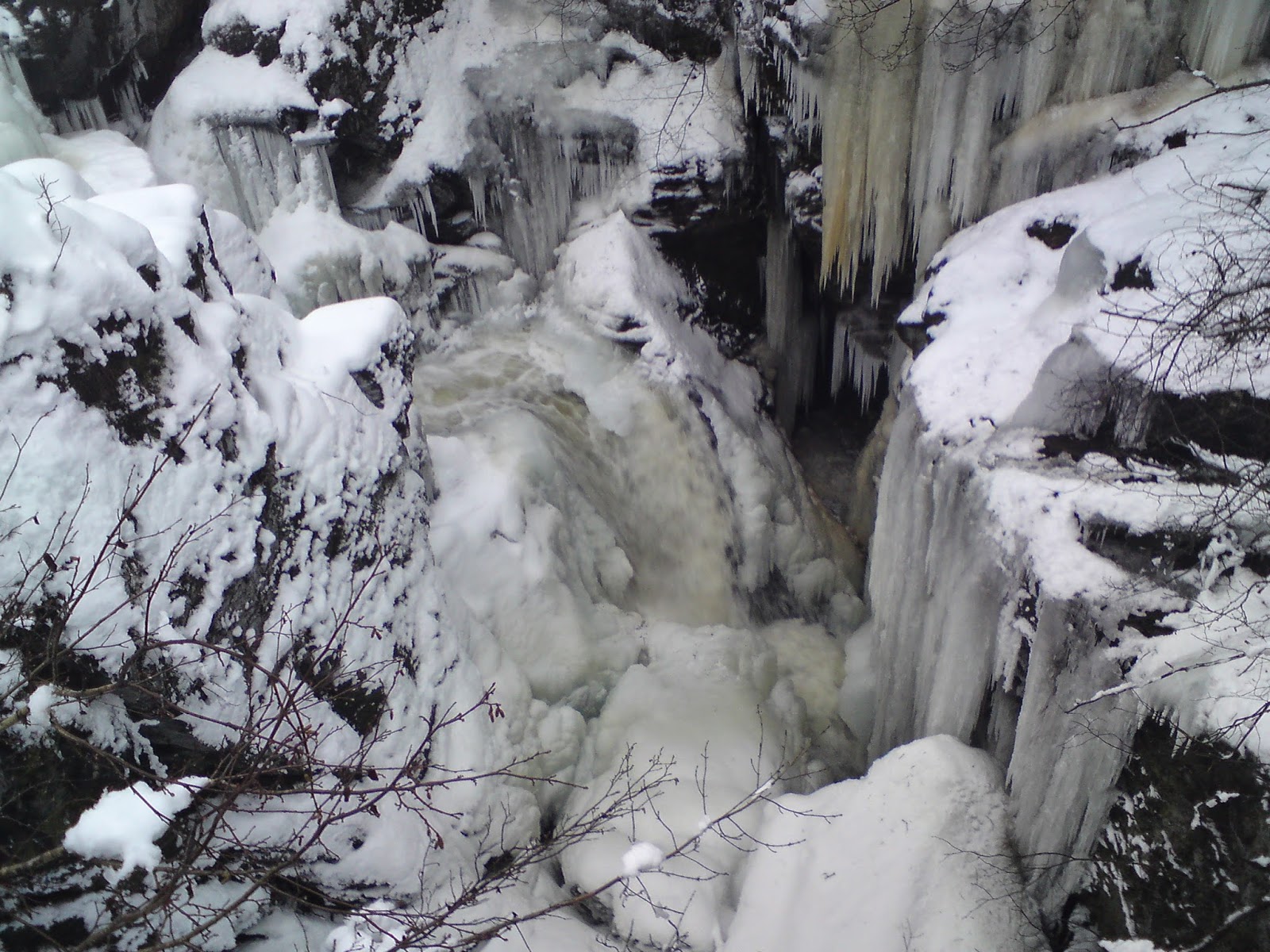
Spent a couple of nights in a self catering bunkhouse outside Aberfeldy we booked for the college to do abit of walking. The first day we drove up to Killikrankie and followed the path up from old faskally farm east then south east. Practised measuring out distances and estimating our time. In heavy rain and thick mist we followed the small path, marked with stones, in a north east direction to Loch a Choire then followed the obvious path zig zagging to the summit of Ben Vrackie. Visibility was zero due to the mist and heavy rain. Descended via the path and returned the same way. Headed back to the bunkhouse for food and made route cards before we relaxed the rest of the evening.
(4.11.09) Meall
Greigh 1001 metres, Meall Garbh 1018 m. 6 hours 30 min, 13.4 km
Parked at
the Ben Lawers hotel where we began our walk at 08.45. The Telford
group with Dave, miles, badger, Fraser and Gregory. Walked along to Machuim
farm and then followed the track up on the east side of the Lawers burn. From
here we took a bearing then climbed the easy grassy heathery slopes in a north
direction to the summit of Meall Greigh. Visibility was zero due to thick mist
along with snow showers. The ground also had scatters of snow. From the summit
we took a bearing and walked north
west to the 993 summit then followed the path around the heathery marshland west to the col
Lairig innein 844m. Followed the fence and path
up the steep slopes to the summit of Meall Garbh which was covered in snow.
Visibility was zero and the summit was around 1 degree although you could see
the sun. Headed east back down to the
col and then south down the boggy heathery slopes following part of the Lawers
burn down to the dam and the land rover track. Walked south east down a footpath along the ridge down to the footbridge crossing
over to the Lawers burn then back to the path
we started.
![]() |
ascending Meall Greigh |
![]() |
Meall Greigh summit |
![]() |
Approaching Meall Garbh summit |
![]() |
Approaching Meall Garbh summit |
![]() |
Meall Garbh summit |
![]() |
on the descent |
Subscribe to:
Posts (Atom)
Ptarmigan November Meet (Callander)
(6.11.2016) Ben Vane & Ben Ledi, 23km. 7hrs. 1,067m ascent Ptarmigan November Meet high tea was at the Lade Inn, just outside Callande...

-
(22.9.2012) Ben Challum, 998m, 5hours 30 min, 10km Parked on the layby , west side of the A82 just north of the turning for Kirkton Farm. ...
-
This was to be me and Steve White’s first 2 Munro’s on a beautiful sunny day. It was a 6am early start from Edinburgh as we drove North and...
-
(28.6.14) Beinn Chabhair 933m, 14km, 6 hours,ascent 1010m Got the bus to Inverarnan then headed around to Beinglas campsite. Crossed the s...